

History shows that February can offer us weather at both ends of the spectrum, but rarely has it done it so dramatically in the space of one month. To start with a good six inches of level snow and end with daffodils in full swing, and bees in abundance, takes some beating. But then, nowadays, ‘normal’ weather seems to be the exception.
February 1 was the winter’s coldest day, the maximum in Wellington being just 2.4C (36.3F). The snow thawed only slightly, and February 2 – Candlemas in the UK, Groundhog Day in the United States – was ominously sunny. Clear skies that night resulted in the month’s lowest minimum at minus 5.6C (22F) in Wellington, but the weather pattern changed significantly the following day, heavy rain arriving on a mild airflow from the west, clearing the last of the snow overnight.
Thus began a frost-free week, with temperatures well above average for the season. With low air pressure close to our shores, there was measurable rainfall every day from February 5-10 inclusive, but also good spells of sunshine. Nature began to respond to the taste of spring.
On February 11 air pressure began to rise steadily, and by February 13 a very strong anticyclone was centred over Germany. In a normal winter, we would expect such a situation to result in severe cold for us. This time, fortunately, the airflow was from the south rather than the east, and we enjoyed unseasonable warmth and sunshine, although a few nights were frosty. February 15 began with fog, but it soon cleared to give total sunshine. With little in the way of wind the air temperature soared, reaching 14C (57F) in Wellington. This is in the ‘remarkable’ category, February maxima above 13C (55F) being historically few and far between.




Although February 16 was generally cloudy with drizzle blowing in the breeze for a short time, it was still mild, and we then enjoyed 11 days with increasing amounts of sunshine. A weak weather front delivered a trace of rain on February 17, with a few light showers the next day, but it didn’t prevent soil conditions drying out to a remarkable degree, considering it was still technically winter. With the continental anticyclone remaining in place, by February 21 we were receiving air that had originated off the north-west coast of Africa.
We then had six days of near-maximum sunshine, with daytime temperatures going into the ‘silly’ category – more normal for mid-April. February 27 saw a new record daily maximum for the month in Wellington, 17.2C (63F) being nearly a degree warmer than the previous record, set in 1998. It was all the more remarkable as the day began with a frost. The last day of the month, cooler with showers on a westerly breeze, was still on the mild side.
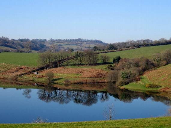
The final statistics are impressive. Although not actually our warmest February, it included a record number of unusually warm days. With night-time temperatures generally close to normal, the overall mean temperature of 6.7C (44.1F) was two degrees above average. Sunshine amounts were about 25 per cent above what we should expect, while the total rainfall of 64 mm (2.5ins) was about 20 per cent down on average. Clatworthy Reservoir was nevertheless still full at the close of the month.
SIMON RATSEY
(WWN weather correspondent)
Comments
This article has no comments yet. Be the first to leave a comment.