

It is very rare for the switch from summer to autumn to coincide with the Equinox. Even rarer for that to occur twice in succession, though this year it was the drop in temperature which heralded the change, rather than the onset of the rainy season. That would be delayed by ten days.
September 1 arrived with bright sunshine after our chilliest night since early June, with a minimum temperature in Wellington of 6.5C (43.7F). The day’s maximum of 20C (68F) was slightly below what we would expect and for the rest of the first week days remained on the cool side in spite of fair amounts of sunshine. With winds from a westerly quarter, there were some showers, though September 6 started wet with a short spell of very heavy rain about noon, the total of 15mm (0.6 inches) making that the month’s wettest day. It was, however, not the start of autumn.
A warm breeze and long spells of sunshine in Wellington on September 8 coaxed the mercury above 22C (72F). This introduced a delightful two-week spell with plenty of sunshine and no measurable rainfall, interrupted only by a single cool, grey day on September 11. There was virtually unbroken sunshine for us on September 13, 14, 17 and 18. Coupled with a flow of air from the tropics this resulted in some extraordinarily high maxima, affecting much of Western Europe also. The maximum of 27.1C (80.8F) in Wellington on September 14 was the highest September reading in our area since 1961, all the more exceptional for its lateness in the season.
The heat led to the development of a thundery depression over the Bay of Biscay, maintaining a flow of warm continental air across much of England. Temperatures stayed above average, some extra sunshine on September 21 resulting in a maximum in Wellington of 24C (75F) – noteworthy but, in fact, slightly lower than on the same date in 2019.
 Flood of objections to proposed housing in fields below Wellington Monument
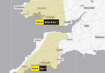 Warning of weekend of snow and ice on top of potentially deadly cold temperatures
 Bargain hunters cram into former WH Smith store with days left before closure
 Wellington fire crews only 30 minutes into New Year before first emergency
This was the end of summer. With a ridge of high air pressure moving in from the Atlantic, over the coming few days the wind veered from south-east, through south-west to north-west, finally becoming a brisk nor’-easter on September 25. Temperatures fell, predictably enough, so in spite of maximum amounts of sunshine during the weekend of September 26/27, in the shade it was decidedly fresh and there were some chilly nights. A minimum of 3.6C (36.5F) in Wellington overnight on September 27/28 would suggest that some rural spots in the area had a ground frost.
To end the month, low air pressure prevailed. Patchy sunshine with a south-westerly breeze gave maxima around 18C (64F) on September 28 and 29 – reasonable for the time of year – but the last day was cool and resolutely dull with heavy bursts of rain, which meant the month did not in the end acquire the label ‘very dry’.
Despite the abrupt cooling-off late in the month, September was much warmer than average, with a mean temperature of 14.5C (58.1F) in Wellington. For our region, it was probably in the top 20 warmest Septembers on record. Added to that, for sunshine it made the top ten. The total rainfall of 45mm (1.8 inches) was only 58 per cent of the long-term average. Overall, a pretty good month.
Simon Ratsey
WWN weather correspondent
Comments
This article has no comments yet. Be the first to leave a comment.