
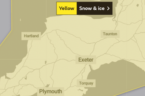
A weather warning for Somerset has been updated because of increased concern over the impact of the show showers expected to arrive in the region from Tuesday night.
The snow and ice warning from the Met Office is in force from midnight on Tuesday night until 9am on Thursday. It says snow could settle up to 10cm deep in places and “may cause travel disruption during Wednesday into Thursday morning”.
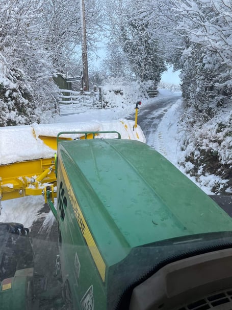
The area covered by the alert includes the whole of the Westcountry and southern England, and extends into mid-Wales. Gritting lorries will be out in Somerset treating roads from 9pm on Tuesday night, and will then be fitted with snowploughs.
National Highways has issued a severe weather warning for snow from midnight on Tuesday night to 3am on Thursday. The government agency is advising motorists to check ahead of their journeys and plan for disruption.


It says conditions are expected to worsen on Wednesday, after morning snow showers are followed by heavier falls in the afternoon, with up to 5cm expected to settle on high ground and routes including Haldon Hill in Devon.
The Met Office is warning the snow could be heavy enough to cause vehicles to be stranded and communities cut off, with the worst hit areas east of the M5.
For Wellington, the forecast is for rain turning to snow at around 2am on Wednesday morning, with the temperature at 1C. Wintry showers with sleet and snow are expected through the day and into Thursday, until the temperature rises to an expected 10C with sunny spells on Thursday afternoon.
Exmoor is forecast to see snow falling from the early hours of Wednesday, expected to last all day and into the night. The temperature at Exford is forecast to drop to zero on Wednesday afternoon before rising through Thursday as sunny spells return between rain showers.
A statement from the Highways Agency said: “Snow is forecast to move north into the South West and the South East tonight. Snow amounts are expected to be small but could be widespread away from immediate coastal areas, with 1-2 cm for many and up to 2-5 cm on any modest hills (Haldon hill in particular).
“The snow is expected to ease during the morning but will be followed by a more significant second wave during Wednesday afternoon and through the evening.
The snow will most likely lose ground in Devon but elsewhere it will be prolonged and occasionally heavy, particularly during the evening rush and to the east of the M5, leading to potential slow traffic and loss of traction on steep inclines (including the A417).
“Current estimations are for accumulations of 2-5cm widely with a chance of 8-10cm on any modest hills (North Wessex Downs, Surrey Hills, North Downs). Any snow will gradually ease after midnight, followed by a cold night with lying snow and icy stretches leading to residual impacts during the morning travel period.”
What to expect:
Possible travel delays on roads with some stranded vehicles and passengers, along with delayed or cancelled rail and air travel;
Some rural communities could become temporarily cut off;
There is a small chance that power cuts will occur and other services, such as mobile phone coverage, may be affected;
A chance of injuries from slips and falls on icy surfaces;
A chance that untreated pavements and cycle paths become impassable.
Comments
This article has no comments yet. Be the first to leave a comment.