

IT was no surprise that, given May’s heat and sunshine, the countryside at the start of June was already looking a bit tired. Even the average person in the street was hoping for some rain.
So, the first two days of the new month offered further unbroken sunshine, the temperature in Wellington peaking at 27.4C (81.3F) on June 2 – too hot for the time of year. Change was on the way, with low pressure developing over France. Rain edged its way across our region on June 3, with a light but cool breeze from the north-east. The resulting 9mm (0.35 inches) was the most rain in one day since mid-March.
The next few days saw the wind shift to become a northerly, with forecasters warning of an influx of Arctic air, as happened in the middle of May. June 5 was a cool, bright day, followed by a quiet night with a minimum of 5C (41F) in Wellington. The next day was miserable – overcast and damp with a maximum temperature of just 12.2C (54F), exceptionally low for June. However, things were becoming interesting.
With Arctic air meeting much warmer air from the near continent, a depression formed over the North Sea. In the absence of a jet stream to shift it, it stayed put, deepening and generating bands of heavy rain that slowly gyrated around the centre of the low. Heavy rain reached us late on June 10, continuing into the night, giving a total in Wellington of 18mm (0.7 inches). Two days later, there was a further spell of intense rainfall in the afternoon, giving another 16mm (0.6 inches). This was a generally autumnal spell of weather.
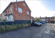 Council says no plans to charge for Springfield Road parking after maintenance work
 MP Rachel Gilmour joins campaign to give special protection to SEND education
 Where there's a will there's a children's hospice lifeline says charity
 Scouts leader mourners asked to wear uniforms or neckerchiefs for funeral service
From June 13 things warmed up again. With winds from a southerly quarter and more sunshine, the temperature in Wellington reached 23.5C (74F) on June 16. By this time, very thundery conditions had developed over southern England, and that day saw severe thunderstorms track along the Quantocks, over to the Brendons and westwards on to Exmoor. In Wellington, it stayed dry. Places only a few miles away experienced a deluge, though Wellington got its own soaking, with thunder and lightning, the following afternoon – another 19mm (0.75 inches).
June 18 proved to be in a different league. A windless day, it began damp and became thoroughly wet, with spells of intense rainfall continuing through the night. Some 42mm (1.65 inches) in the Wellington rain gauge next morning was the third heaviest June ‘daily’ rainfall total in living memory, February 2014 being the last time we had a wetter day in this area.
As we approached midsummer, the heat returned. There was some searing sunshine and the maximum of 31C (almost 88F) in Wellington on June 25 has been exceeded in June only three times since the legendary summer of 1976. But the heat was short-lived, with a further relapse into unsettled, rather autumnal conditions for the end of the month.
In summary, with 132mm of rain (5.2 inches; 220 per cent of the average) it was the fourth wettest June on record in Wellington – but possibly the wettest-ever for some readers of this column. The mean temperature of 15.8 C (60.4F) was well above normal, too, while sunshine amounts were close to average.
SIMON RATSEY
WWN weather correspondent
Comments
This article has no comments yet. Be the first to leave a comment.