
With Clatworthy Reservoir full to overflowing at the start of the year, and our water supply guaranteed for now, the last thing needed was more rain. Clearly, that message did not get through. There would be rain, often heavy, every day for the first half of January.
Having basically the same weather pattern as during the Christmas period, it was no surprise that it remained very much on the mild side, with winds generally from the south-west. While New Year’s Day – a Sunday - was dull and damp, skies cleared for the bank holiday Monday that followed, with more or less unbroken sunshine making it a good day for a brisk winter walk.
The rest of the first week was cloudy but unseasonably mild, with a very wet afternoon on January 3, while January 6 saw overnight gales and some torrential rain early the next morning, as a deep Atlantic depression tracked across the country.
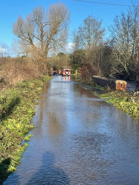
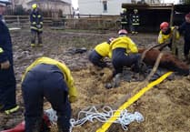
It remained breezy for the next few days, the wind being especially warm on January 10. The maximum temperature of 13C (55F) in Wellington was the equal tenth-highest January reading on record locally, but warm air can contain more moisture and January 11 was wet throughout, with a few rumbles of thunder for good measure. The 31mm (1.2 inches) in the Wellington rain gauge next morning explained why flooding had become more widespread in the area. Although January 13 was a reasonably sunny day, another 25mm (1 inch) of rain that night topped up the already overloaded rivers and streams. Fortunately, the heavy showers during the morning of January 15 would prove to be the last significant rain in the month, as a strong anticyclone became established.


The drier weather was accompanied by a significant drop in temperature, the wind veering to the north and then falling away completely. January 16 – 24 was an unusually sunny spell, but the temperature failed to reach 3C (37F) on January 17, and there was a shower of sleet and snow on the morning of January 18 that left a short-lived light snow cover on hills above about 600 feet. There were nine successive nights with frost, with an extreme minimum of minus 5C (24F) on January 24, by which time the ground in shady places was frozen to a depth of more than 3 inches.
The last week of the month saw a return to more unsettled conditions, with temperatures close to normal, sunny spells, and only a tiny amount of rain, as the active weather systems were following a track well to the north of us.
In summary, it was a notable month for several reasons. The first half was the warmest on record here, while the second half was the coldest since 2011. The overall mean temperature of 5.4C (41.7F) in Wellington was more than half a degree above average, despite the cold spell. With a total rainfall of 151mm (5.9 inches) it was the tenth-wettest January since 1960, in this area. However, almost all of it fell before January 16, which marked the end of a 30-day spell with rain every day totalling 289mm (11.4 inches) - getting on for 30% of a year’s worth. In 2014, we had a much longer continuously wet spell, but with only slightly more rain.
Comments
This article has no comments yet. Be the first to leave a comment.