

A COLLECTION of more than 50 old maps of Wellington and the surrounding is being put on show.
Wellington Local History and Museum Society does not have enough room in the town’s museum to properly display them.
So, the society has hired Wellington Community Centre for the morning of Saturday, August 6, and is inviting people to go along to view the maps.
The maps date from the early 19th century to the present day, and there are also several 20th century aerial views of the town.

Museum curator Colin Spackman said among the items on display is a 1887 Wellington town centre map at a scale of 1:500, a Wellington entire urban area 1887 map at a scale of 1:2500, and some 1920 maps of nearby villages Langford Budville, Nynehead, and Sampford Arundel.
A Somerset map circa 1809 is also included, together with a page from Ogilby’s 1675 road atlas showing the route from Bristol to Exeter via Wellington - the present-day A38 - and several 1930s aerial views of the east Wellington.
The maps are available to view from 10 am until 12 noon. Entry to the community centre is free.
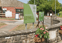
The community centre can be found off High Street, alongside the Royal Mail sorting office in White Hart Lane.
Comments
This article has no comments yet. Be the first to leave a comment.