THE closing sentence of November’s weather report – “And whatever December throws at us…” – was not meant as a challenge, but 2017 culminated with a memorable variety of weather types, not all pleasant.
December 1 was bright with a chilly breeze that kept the temperature in Wellington below 5C (41F). Over the next few days a milder airflow raised temperatures but it was rather dank. Then, on December 6, storm ‘Caroline’ slammed into western Scotland, where there were severe gales. For us, the main effect was a rapid rise in temperature on a strengthening south-west wind, followed by a relapse the following day caused by a short-lived blast from the North Pole.
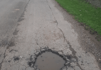
There was bright sunshine on December 8, but it did little to offset the chill, with a slight frost that night as the wind eased. December 9 was cold and quiet, as if the weather was taking a breather before its next planned onslaught. That arrived as a south-westerly gale, with rain, torrential at times, starting in the small hours. Some 21mm (0.83in) had accumulated in the Wellington rain gauge by 9am the next day, with a similar amount being added before the rain finally petered out during the night of December 10/11. This total (42mm) was the year’s largest fall of rain but caused only localised minor flooding.
Next, there was a brief taste of the Arctic, December 11 having an afternoon with blue skies and sparkling visibility on a light northerly breeze. The minimum temperature of minus 3C (27F) that night was Wellington’s lowest reading of the month. December 12 began bright and ended dull as the next lot of rain approached, the following day being wet and windy, with squally hail-showers that night.
Frequent showers of rain and sleet on a brisk west wind made December 14 a very nasty day, but it would be followed by ten days of unusually benign winter weather. There were four days with sunshine, almost no rain, little wind, and one slight frost. With high pressure over the near continent, our region then became bathed in a cloudy, mild airflow from the south-west. In the run-up to Christmas we had almost a week with temperatures far above normal by day and by night.
Things changed on Christmas Day, which began mild and damp, but ended cold with heavy rain. Boxing Day offered early sunshine but a vigorous depression brought further rain by afternoon. This continued into the night with some intense bursts, the total in the rain gauge next morning amounting to 22mm (0.87in). A light snow cover enhanced the tops of the Brendons and Quantocks. After two beautiful sunny, chilly days, the south-west wind picked up once more, reaching gale force in the night of December 29/30. There was more rain, but it was a warm wind, giving an unusually high maximum of 13C (55F) in Wellington on December 30, but cold, blustery showers returned for New Year’s Eve.
Wellington’s December rainfall figure of 134mm (5.3in) was 116 per cent of the average, while the total of 858mm (33.8in) for the year was about 13 per cent below normal. Overall it was a mild month and – amazingly – the seventh in succession to be much warmer than average. No less surprising perhaps is the fact that Met Office figures place 2017 as the fourth warmest year on record in England.
SIMON RATSEY
WWN weather correspondent
Comments
This article has no comments yet. Be the first to leave a comment.