

ANY discussion about spring snowfall must consider the events of mid-March 1891. After a severe winter, two massive snowstorms within 48 hours struck southern England, with a howling easterly gale. Level snow was measured at a yard deep over parts of the South-West, with truly monumental snowdrifts. Trees were felled in their thousands, railway trains stranded and ships wrecked, with much loss of life of people as well as livestock. Remnants of snow-drifts lasted until June.
This year, after a very cold night (minimum: -6C or 21F), it started snowing during the morning of March 1. Within 24 hours it had accumulated to a depth of about 20 cm (8in) in Wellington, causing travel problems and panic-buying in the shops. It was also the coldest March day on record here, with a maximum of -1.7C (28.9F). This meant that, rather than as snowflakes, the snow initially arrived as fine grains that blew into every nook and cranny.
That night it rained. The rain froze on top of the snow, with further snowfall later, creating what became widely termed the ‘crème brulee’ effect. March 2 saw spells of light snow or freezing rain throughout the day. However, the severe spell was coming to an end, with both rain and sun during the next few days bringing about a steady thaw, and by March 6 snow was lying only in the most shaded places and where the deepest drifts had formed.
We then had ten days with daytime temperatures above 10C (50F), and some heavy rain on both March 9 and March 11. Between those, a pleasant day with sunny spells and a light south-west wind saw a maximum in Wellington of almost 14C (57F). But with a weak jetstream still following a track that was much further south than normal, our region was to be targeted by slow-moving depressions for the rest of the month. One of these gave more than 12 hours of heavy rain, starting before lunch on March 14. This produced a total of 35mm (1.4in) in the Wellington rain gauge, the highest ‘daily’ fall on record for the month.
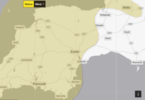 Warning issued for whole of Christmas Day as strong winds set to hit Westcountry
 Wellington man dies in hospital 13 days after woman's attempted murder arrest
 Wellington among three fire crews working to free horse trapped in farm slurry pit
 Wellington to lose its former WH Smith store just five months after takeover
There was further heavy rain the following night but the next depression to arrive drew another blast of air from Siberia. March 17 was ten degrees colder than the day before, with heavy snow that night, although this time the ground was warmer so there was some melting from beneath. March 18 saw further snow, the temperature rising only to -0.5C (31F), making that the latest date in the year to have a sub-zero maximum in this area.
Things became significantly warmer from March 20, with good spells of spring sunshine – notably on March 25 – as well as less-welcome rain. Though frost-free, this period saw no especially warm days, and as Easter approached there were warnings of further bad weather to come. We were spared the snow this time, but Good Friday (March 30) was cold with another 18mm (0.7in) of rain for good measure.
In summary, with a total precipitation of 185mm (7.3in), it was our wettest March in living memory. The mean temperature of 5.4C (41.7F) was well below average, and close to normal for February – balancing out the exceptional warmth of March 2017.
SIMON RATSEY
WWN Weather correspondent
Comments
This article has no comments yet. Be the first to leave a comment.