


LOOKING through my files at the weather reports for January during the last ten years or so, I am struck by how rarely it has been cold. In fact, since the rather chilly January of 2010, only in 2013 did we have ‘proper’ snow, with the recurrent theme having been unusual mildness.
This year began on an unsettled note, as fronts brought spells of heavy rain, frequent changes of wind direction –and so also temperature – and gales during the night of January 2. Nearly 30mm (1.2in) of rain in Wellington in the first four days left the ground saturated. As air pressure rose on January 5, the wind direction veered to north-west, and in the following days to the north-east, never a warm direction but at least it was dry. With little sun, and temperatures below 4C (39F) for three days in succession, it felt more like winter.
A warm front on January 9 made it slightly milder with enough rain to leave things in a muddy state once more, before cool conditions returned, but the next two days offered lots of sunshine in compensation. Clear skies overnight on January 11/12 led to a thick hoar frost on the grass, though the minimum temperature of minus 2.8C (27F) in Wellington was not really that low.
Approaching mid-month, the unsettled weather pattern re-established itself, with a succession of depressions crossing the Atlantic on a strong jet stream. January 14-17 together added another 45mm (1.8in) of rain, and there was to be some precipitation every day but one to the end of the month, though rarely enough to wash the roads clean. Temperatures fluctuated between very mild and chilly, with a dusting of snow on high ground on January 16, but the general windiness of the period kept it frost-free.
 Bell which has seen one hundred years of town crying in Wellington
 Town council video records 2025 highlights from 'special year' for Wellington
 Protect Wellington group declares opposition to Pegasus countryside housing proposal
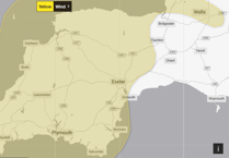 Warning issued for whole of Christmas Day as strong winds set to hit Westcountry
On January 20, high pressure over France edged northwards, bringing a very mild flow of air from the south-west. A couple of nights saw temperatures stay in double figures, while January 23 was one of the warmest January days on record in Wellington with a maximum of 13.8C (56.8F). There was a brief spell of heavy rain first thing on January 24, but the following two days were mostly sunny and very pleasant. The unusually high mean temperature of 8.4C (47F) for the week ending on January 28 was actually average for April, so it’s no surprise that crocuses were suddenly blooming everywhere.
It was ‘chop and change’ to end the month. January 29 began mild, windy and damp, but ended calm with clear skies that led to another hoar frost. Bright sunshine in the morning of January 30 was replaced by hill fog and drizzle later, while January 31 saw blustery showers arriving on a distinctly chilly polar airflow.
The summary statistics for January 2018 show that rainfall was ten per cent above normal at 119mm (4.7in). Though dull it was mild, with 13 days having maxima in Wellington above 10C (50F) and only six nights with frost. The month’s mean temperature of 5.8C (42.4F) was 1.2C above average, and the past 12 months constitute one of our warmest such periods ever. Mother Nature might appreciate a bit of chill before spring really gets going!
SIMON RATSEY
WWN weather correspondent
Comments
This article has no comments yet. Be the first to leave a comment.