

It’s remarkable that, in the 20 years since this regular column commenced, the ‘Ice Saints’ have scarcely got a mention. In the last century they seemed to be a regular feature of our climate. Readers with internet access can find out all about them, if so inclined.
There was nothing remarkable about the way May began. The first two days were sunny with average temperatures, and a little rain falling – conveniently – after nightfall, while May 3 was overcast and damp with a cool breeze from the east. After a dismal repeat performance two days later, the month became basically sunny. Just 8mm (0.3 inches) of rain in the first week would prove to the sum total.
Unbroken sunshine on May 6 marked the start of a brief hot spell, temperatures rising daily to a notable peak of 25C (77F) in Wellington on May 9. Such wind as there was came from an easterly quarter. However, our weather forecasters were warning gardeners to beware, as a plunge of Arctic air was on its way. This reached our region on May 10, the temperature in Wellington falling from 21C (70F) mid-morning to only 10C (50F) by supper time.
That night there was a ground frost, with an unseasonably cool day to follow. There were widespread air frosts on the nights of May 11 (Feast of St Boniface of Tarsus) and May 13 (ditto, St Servatius), with an air temperature of minus 1C (30F) recorded in Wellington. The lower temperatures at ground level resulted in the ‘scorching’ of some tender plants. We have to go back to 1995 for such a chill so late in the year.
 Bell which has seen one hundred years of town crying in Wellington
 Town council video records 2025 highlights from 'special year' for Wellington
 Protect Wellington group declares opposition to Pegasus countryside housing proposal
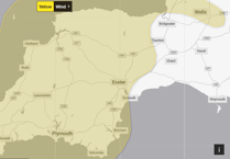 Warning issued for whole of Christmas Day as strong winds set to hit Westcountry
Far from limiting the sunshine, the change of air mass enhanced it. With exceptionally clean air we enjoyed five days of almost uninterrupted blue skies, though temperatures were definitely on the cool side. Then a cloudy spell during the morning of Sunday, May 17, signified the change of wind direction to a milder westerly, with more very warm weather being forecast.
Light winds and sunshine saw temperatures in Wellington reach 22C (72F) on May 18 and 19. After a foggy start to May 20, that day became even warmer with a maximum of 25C (77F). Forecasters at this stage were speculating over the possible impacts on us of an unusually active Atlantic storm system in the Western Approaches. Strong winds were certain, significant rainfall in our region less so. As things turned out, Wellington received immeasurably small amounts during the nights of May 20 and 21, while western Scotland had a drenching.
After a couple of breezy, cooler days, things settled back into ‘hot and sunny’ mode for the final week of the month. The highest temperature of 27C (81F) on May 31 broke no records but the last time the month gave us such a spectacular spell of weather was in 2012. That it was followed by the wettest June on record should not be taken as a forecast for this summer.
Despite a cool first half, May 2020 ended up much warmer than average with a mean temperature of 13.5C (56.4F). Receiving just 13 per cent of the average amount of rain, it was the equal-second driest May on record in this area, and the sunniest by a big margin, topping off the sunniest spring ever recorded.
SIMON RATSEY
WWN weather correspondent
Comments
This article has no comments yet. Be the first to leave a comment.