

Whatever the impression given by conditions in late November, it has been a remarkably benign autumn and among the warmest on record. With only four weeks to go until Christmas there was still plenty of autumn colour in the trees, and summer bedding plants continued to bloom in sheltered outdoor spots.
November 1 was a bright day with sharp showers blowing in from the west, but that would prove to be the last significant rainfall for almost four weeks. A ridge of high air pressure quietened things down, the next three days offering plenty of sunshine with a gentle breeze from the north. It managed to drizzle for a couple of hours late on November 6, after which the wind backed to a westerly as a large anticyclone settled over the continent.
Thanks to that, the middle fortnight of November was unusually mild and dry, with generally light winds. Daytime temperatures in Wellington were mostly in the range 13-15C (55-59F), with a few nights when the temperature stayed in double figures, way above average. It was a generally cloudy spell, with some overnight drizzle on November 11, and light showers which soon cleared the next morning. November 13 saw rising air pressure once more, sunny spells boosting the temperature, with more sunshine for the Remembrance Sunday service in Wellington Park the following day.
There were then a few calm, rather grey days, but the low cloud first thing on November 18 soon lifted to allow occasional glimpses of sunshine, giving another unseasonably mild day. There was a little drizzle the next morning, while a brief spell of rain during the night of November 20 marked the passage of a cold front which introduced a polar airstream. Prior to this change, it was shaping up to be one of the warmest November’s on record.


Instead, high air pressure over the Atlantic would now place the British Isles under a very chilly airflow, for the next ten days. November 22 began with the first air frost of the autumn in Wellington, a full fortnight later than we would expect it. A sunny day followed, but the maximum in Wellington was barely 7C (45F), the next three days having similar temperatures and only limited amounts of sunshine.
November 26 dawned wet, turning showery with bright spells, and although the thermometer said it was milder, the strengthening north-west wind added a significant chill factor. During that night Storm Arwen, the first named storm of the season, gathered strength as it tracked south-eastwards across Scotland and over the North Sea. Northerly gales in its wake made Saturday November 27 the coldest day, with a maximum in Wellington of just 5.5C (42F), stripping many trees bare and thwarting plans for the celebratory switch-on of the Christmas lights. Although the end of the month was slightly less cold, it marked the start of a more unsettled spell, with as much as 5mm (0.2 inch) of rain arriving in the final hours.
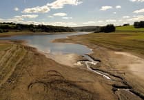
In the end, November’s mean temperature of 8C (46F) was nearly a degree above average, and it was a relatively sunny month, too. The most remarkable statistic was that the total rainfall in Wellington of just 19mm (0.76 inch) made it our driest November in the past 60 years, and possibly the driest ever.
Simon Ratsey
WWN weather correspondent
Comments
This article has no comments yet. Be the first to leave a comment.