

Making long-term weather forecasts is famously risky, but one could confidently predict that the maximum temperature of 14.5C (58F) in Wellington on New Year’s Day would not be exceeded during the rest of the month. It was our warmest January day on record, and even with climate change, anything warmer than that before the end of February would be highly improbable.
Unsettled weather characterised the first third of January, but the month’s heaviest fall of rain – 13mm (0.5 inches) on January 2 - was a very modest total. The strong and unusually warm airflow from the south-west that began the year was soon replaced with polar air, with sleety showers in Wellington on January 4 which fell as snow on the tops of the Brendons. January 5 was bight but chilly, to be followed by a most unpleasant three-day spell with squally winds and rain, turning to heavy sleet for a while on January 7.
After this things quietened down, with a large anticyclone developing over France. A light breeze from the west briefly raised temperatures above normal, with a maximum of 12C (54F) on January 11, but clearing skies that night resulted in our first proper frost for three weeks, after which most nights were on the chilly side. January 12 and 13 offered about as much sun as is possible at that time of year, though dense fog at first on January 14 prevented a ‘hat-trick’ of really sunny days. A weak weather front then gave a couple of damp, grey days, before January 17 basked in unbroken sunshine, clear skies that night revealing a spectacular full moon.
High air pressure would then remain firmly in control of our weather for the remainder of the month, light breezes from a northerly point giving plenty more sunshine up to January 21. That night gave us our hardest frost of the winter, the mercury dropping to minus 5C (23F) in Wellington – by no means exceptional – and in the absence of any wind, the next few days were depressingly dull and cold. January 25 was our coldest day of the winter with a maximum of just 4C (39F), falling in what is on average the coldest week of the year. Nature will probably benefit from that bit of normality, as misguided bees had been seen foraging at times earlier in the month.

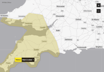


The last few days of January were significantly milder. Two major storms crossed the north of the British Isles in quick succession, inflicting much damage, but our region remained under the influence of high pressure. Winds from a westerly quarter brought a little inconvenient dampness at times, but there was also a fair amount of sunshine, notably on January 30.
After the very mild start, the subsequent more seasonally-appropriate conditions resulted in January’s mean temperature of 5C (41F) being only slightly above the long-term average, as was the amount of sunshine. The total rainfall, however, was less than half the average, amounting to just 52mm (2 inches) in Wellington, most of it arriving before January 9. With the water level at Clatworthy Reservoir reported to be already starting to fall, perhaps we should be hoping for a significant wet spell, preferably before the arrival of spring and the cricket season.
Simon Ratsey
WWN weather correspondent
Comments
This article has no comments yet. Be the first to leave a comment.