


TO begin with the bad news, there is an increasing probability that a typical 21st Century August will be something like the month just ended. Yet again, it was disappointingly dull, with just a few hot sunny days, but numerous very mild nights. For the fifth time in the last decade it was much warmer than average, without really giving that impression.
Only those who were tired of this summer’s heat would have complained about the first week of the month. It included four days with a maximum in Wellington above 27C (81F), a reading exceeded only once in August here since the heatwave of 2003. Of those days, Sunday, August 5, stood out, offering unbroken sunshine, the others being oppressively humid with variable amounts of cloud and just a light breeze.
Temperatures in the second week were closer to normal, as Atlantic weather systems made things more unsettled. There were heavy showers during the afternoon of August 8, while August 11 was overcast from the start with a south-west wind became strong and gusty later. That night it rained heavily, the 21mm (0.84 inches) in the Wellington rain gauge being our largest fall since mid-March. At last, rainwater butts were recharged, and the soil soaked enough to really benefit our garden plants.
Following this, a subtropical airflow from the south-west prevailed. It brought much cloud, but the only significant rain was during the night of August15/16. There was a run of very stuffy nights, with a minimum in Wellington of 17C (63F) on August 19 making that the warmest night of the year. This was linked to an influx of air in the circulation of ex-tropical storm Ernesto. Even without much sunshine, daytime temperatures exceeded 24C (75F) on August 20 and 21, and up to this point, the average temperature for the month was running at more than 2C above normal.

-teacher-and-coordinator.jpeg?width=209&height=140&crop=209:145,smart&quality=75)
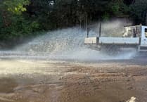

The last ten days of August had an increasingly autumnal feel. Winds continued to be generally from a westerly direction, with some – mostly light – precipitation every day from August 21-28. The worst day was August 26, when rain from the start became progressively heavier during the day, finally clearing by dusk. The south-west wind became very gusty but actually warmed things up a bit. The three coolish days and nights beforehand had been unfamiliar territory.
The month ended with calm conditions, high pressure once again being in charge. After a chilly night with a minimum of 5.5C (42F), and too late to affect the basic facts, August 31 offered plenty of sunshine. And after a summer that arguably began in early May, have we any real cause for complaint?
The statistical summary for August 2018 runs thus. With a mean temperature in Wellington of 17.3C (63.1F), it ranks as the tenth warmest in the past 60 years, with average temperatures both by day and night well above normal. While the available data suggest that sunshine amounts were less than 90 per cent of average, it was not a wet month. Measurable rainfall on 13 days amounted to 66mm (2.6 inches), which is just 5 per cent above average, with total rainfall for the year so far being also near normal.
And the good news is that Septembers are tending to become warmer and drier.
SIMON RATSEY
WWN weather correspondent
Comments
This article has no comments yet. Be the first to leave a comment.